Geography
  What makes Sri Lanka striking is the diversity of scenaries from one city to another that captivates visitors to the sunny Island. Brilliant green paddy fields, sun-bronzed beaches, ruined cities , rustic villages, wild life sanctuaries, tropical jungles and hill-country tea plantations literally within hours of each other. Sri Lanka lies at the southern tip of India, a teardrop-shaped island separated from the Indian mainland by the shallow Palk Strait. Between Sri Lanka's southern coast and the frigid Antarctic there lies no other landmass.  
The weather is tropical - bright and hot for most part. Rains come in two main monsoons that originate in the Indian Ocean. The country has specific climatic zones determined by ranges of high mountains that run in north-south direction in the center of the island. The larger geographical area, fed by the north-east monsoon stays hot and dry for long months of the year, while the west and parts of the south of Sri Lanka has a primarily wet and humid climate.
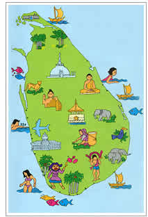
  From sea level to 7000-foot high national parks, the country boasts of myriad geographical and climatic zones. From the coconut palm fringed beaches of the west coast to lush rainforests of Ratnapura (2 hours from Colombo) to the stunning mountain scenery of Haputale (5 hours from Colombo) to the arid, scrub jungles of Yala (7 hours from Colombo) - a traveller in the country will never bore of the constantly changing patterns of the countryside. It is easy to imagine, when travelling across Sri Lanka, why Marco Polo called it the finest island of its size in the world.

The country is six hours ahead of GMT.